At 7:37 AM Philippine Standard Time on Monday, June 8, 2026, a 7.8 magnitude earthquake struck off the coast of Sarangani province in southern Mindanao. The epicenter sat about 26 kilometers west-southwest of Kablalan, placing it offshore—which maximizes the tsunami risk.
It is the strongest earthquake to hit the Philippines since 1990.
The USGS confirmed the 7.8 magnitude after several revisions. PHIVOLCS initially read the quake at 7.0, while Germany’s GFZ Research Centre ran it up to 8.2 before pulling back. The US National Tsunami Warning Center eventually settled on 7.8. At this depth and offshore location, that magnitude carries real destructive force. Depth estimates ranged from GFZ’s 10 kilometers to the USGS’s 35 kilometers. Shallow ruptures transfer more energy to the surface, making them more dangerous.
Multiple strong aftershocks shook the area for over an hour, keeping residents outdoors. PHIVOLCS recorded several follow-on tremors in Sarangani during the morning.
The Tsunami Warning: Which Areas Are Under Alert
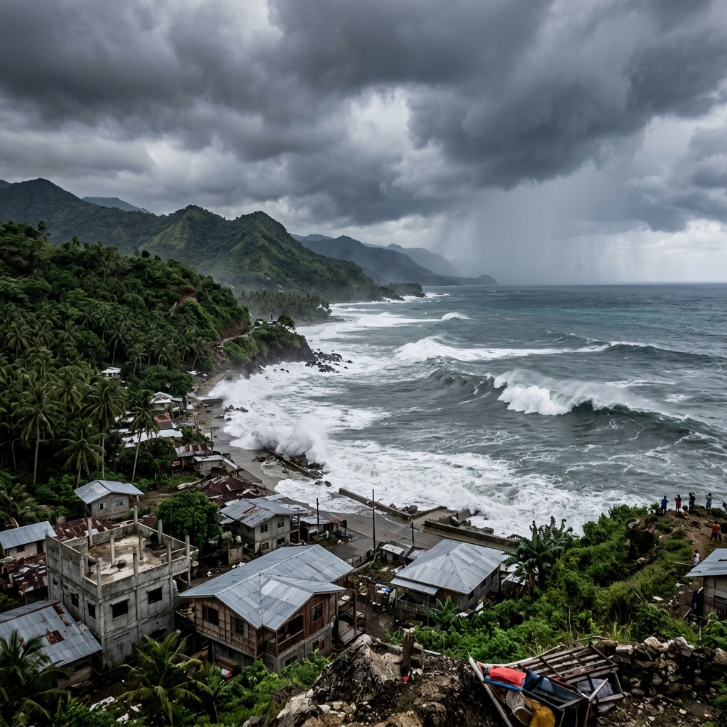
PHIVOLCS issued an immediate tsunami warning covering nine provinces across Mindanao’s coastline. The Pacific Tsunami Warning Center projected waves up to 3 meters above normal tide levels. PHIVOLCS warned that waves starting between 7:37 AM and 9:37 AM could continue for hours.
The provinces under evacuation orders include Sarangani, Davao Occidental, Tawi-Tawi, and Sulu. PHIVOLCS told residents to move to higher ground immediately and stay away from the coast. Coast Guard officials suspended all marine traffic in Southeastern Mindanao, halting fishing, passenger, and commercial boats.
Indonesia’s BMKG issued parallel tsunami warnings covering the Maluku Islands, Sulawesi, and Borneo. Evacuation orders went out for northern Sulawesi’s capital Manado, northern Gorontalo province, and the Sangihe Islands. Malaysia’s Meteorological Department warned Sabah state on Borneo. Japan also issued alerts for its coastal areas.
By midday, Indonesia’s BMKG lifted its tsunami warning. The agency recorded small tsunami waves at nine locations across Indonesia, peaking at 0.75 meters in Sangihe. Actual 1-meter waves hit nearby coasts, alongside an 83-centimeter wave measured by a gauge off Sulawesi—dangerous, but well below the worst-case projections.
Damage on the Ground: General Santos City
General Santos City, a commercial hub of over 700,000 people, sits directly in the impact zone. This is where the worst structural damage has been reported so far.
A three-story building housing a fast food restaurant collapsed in General Santos City, caught on video and circulating on social media. A high school in Matanao and a local donation center also reported partial collapses. Images from local offices showed convenience stores with caved-in walls, smashed windows, and debris-covered streets.
Benjie Ancheta, the police chief of Alabel town in Sarangani, said the quake hit during their morning flag-raising ceremony. The police station sustained visible cracks, and several people fainted from shock. No fatalities have been confirmed, though disaster agencies are still collecting reports.
Mary Ann Blanco Rhudy, a Catholic nun traveling in General Santos, described cars moving erratically on the road and trees swaying violently. She reported partial collapses in Notre Dame of Dadiangas University buildings.
The Government Response
President Ferdinand Marcos Jr. directed all government agencies to coordinate evacuation and rescue. His message to coastal residents was direct: “Move to higher ground now. Do not wait. Your life is more important than anything left behind.”
Disaster agencies activated regional response teams. The government opened temporary shelters, while public works crews prepared to clear blocked roads. Local hospitals are currently operating under crisis protocols.
The US Embassy in Manila issued an emergency alert advising American citizens to evacuate tsunami warning zones immediately.
Why Mindanao Gets Hit Like This
The Philippines sits on the Pacific Ring of Fire, where about 90% of the world’s earthquakes occur. Mindanao lies right on the boundary of the Sunda and Philippine Sea plates. This convergence is absorbed by a network of fault lines, including the Cotabato Trench.
This morning’s earthquake was caused by thrust faulting on the Cotabato Trench system.
That same trench produced a magnitude 8.1 earthquake and tsunami in 1976 that killed 8,000 people. The memory of that disaster, which wiped out entire coastal communities across the Moro Gulf, explains why authorities moved so quickly this morning. Today’s 7.8 is the largest earthquake in the country in 36 years.
What to Watch as This Develops
Expect casualty reports to rise as teams reach isolated coastal areas. Aftershocks following major thrust-fault ruptures can run for days or weeks, and some may trigger localized hazards.
Check official updates from PHIVOLCS at phivolcs.dost.gov.ph and stick to instructions from local authorities instead of social media reports. If you are in coastal Mindanao, follow evacuation orders. Do not return to the coast because the first wave has passed; tsunamis arrive in multiple surges, and later waves are often larger.
Further Exploration
- Real-Time Earthquake Bulletins: PHIVOLCS Official Portal
- Mindanao Seismotectonic Maps: USGS M 7.8 Mindanao Earthquake Event Page
- Tsunami Warning System Bulletins: Pacific Tsunami Warning Center (PTWC)
- Sunda and Philippine Sea Convergent Fault Systems: Germany’s GFZ Seismology Database
About the Author
By your 44-year-old geology teacher uncle who has been tracking Pacific seismic events.